Nefino.LI Geo
Fast and precise area analyses without any GIS expertise!
Why Nefino.LI Geo?
The federal government’s plans for the expansion of renewable energies have triggered a veritable boom in the German wind and solar energy market. By 2030, more than 80 GW of ground-mounted photovoltaic systems are to be realised and by 2032 a total of 2% of the country’s land area is to be available for wind energy.
The challenge for project developers to find the urgently needed areas, secure them and develop them with the necessary permits is greater than ever. At the same time, the industry lacks the necessary specialists who not only understand the extremely complex framework conditions for new wind and solar parks, but can also actually apply them in digital analyses.
With Nefino.LI Geo, we have created a digital tool that solves precisely this problem. It enables project developers without any GIS knowledge of their own to quickly and precisely check any area for its suitability for new wind and solar energy plants.
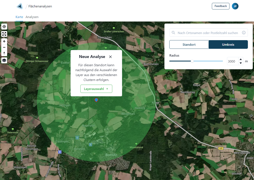
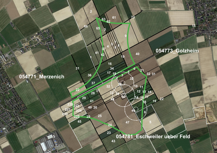
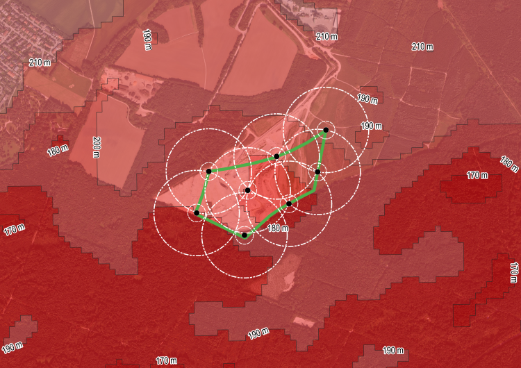
For this purpose, the web-based software-as-a-service application offers intuitive operation tailored to this use case. It is made available to the user with an already integrated geodatabase that really does provide all the updated geodata needed for a detailed initial assessment of the quality of a site. Minimum distances from residential buildings can be set precisely, nature, landscape, species and water protection concerns can be checked individually and any conflicts with aviation can be identified at an early stage. The eligibility of a potential photovoltaic area for EEG compensation can also be checked directly.
The highlight: Our wizard-based user guidance accompanies the user step by step through the entire analysis process: from site selection, through geodata and buffer selection, to taboo zone determination. In each individual process step, the user only has to specify where to analyse and what to consider. All steps of geodata processing, i.e. in particular acquisition, buffering and intersection, are carried out fully automatically in the background.
An overview of all geodata available in Nefino.LI Geo can be found here.
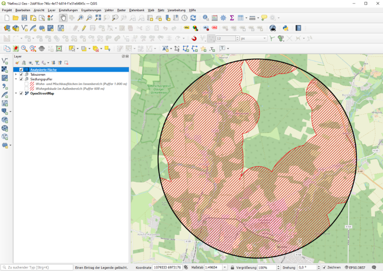
The integration of Nefino.LI Geo into the web-based geoinformation system WEGA of our partner M.O.S.S. also enables direct viewing and processing of the results in the browser after the analysis. Alternatively, the software offers the possibility of local display of results and further processing as a QGIS project. Since the export of the results can also take place in different file formats and the most common coordinate reference systems, as well as preconfigured and company-specific styles for the uniform visualisation of the results are possible, with Nefino.LI Geo we guarantee a high level of compatibility with our customers’ company software and conventions.
Make yourself less dependent on rare GIS expertise with Nefino.LI Geo and boost the efficiency of your land protection and project development!
Use Nefino.LI Geo for various use cases
Securing land
With Nefino.LI Geo you focus your scarce resources on the right areas
As a project developer, you are increasingly confronted with enquiries or tenders from land owners who want to tackle the project development of a wind or solar park together with you. At the same time, however, you lack the time and/or the data to decisively check whether the areas offered have any spatial planning and economic potential at all for a joint project.
With Nefino.LI Geo you can quickly and precisely separate the relevant from the irrelevant enquiries and devote yourself intensively to the areas that actually have a high realisation potential after the detailed initial assessment.
Portfolio valuation
Nefino.LI Geo gives you a quick and precise overview of the potential of the portfolios on offer.
As a project developer or investor, you are always faced with the challenge of having to evaluate new portfolios that are offered to you for sale in the shortest possible time. Regardless of whether these are project or wind farm portfolios, you will first be interested in how much greenfield or repowering potential the respective portfolio actually has before you delve deeper into the contractual and general conditions.
With Nefino.LI Geo, you can perform a high-performance analysis of any site throughout Germany and, after the detailed initial assessment, precisely evaluate which area or which wind farm of a portfolio has which potential, in which order of magnitude and with which probability of realisation.
Wind park acquisition
Increase your hit accuracy in the purchase of repowerable wind farms
As a project developer or investor, you are interested in expanding your fleet by purchasing wind farms. In doing so, you primarily want to create new business opportunities for your project development by focusing on repowerable wind farms.
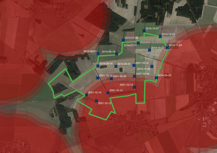
With Nefino.LI Geo you can analyse all existing wind farm locations throughout Germany with regard to their repowering potential and specifically address those that fit your investment focus. If desired, you can also obtain all the master data on the wind farms you have selected, as well as information on their current owners.
Project development and permit planning
Optimise your efficiency in project development and approval planning
As a project developer, you are often confronted with changes in the relevant framework conditions and also the technologies to be used during the project development and approval planning of a secured area, which often takes many years. For example, a new type of wind turbine may lead to new distance requirements, or a previously unconsidered aviation restriction may limit the height of your wind turbines.
For this, you need a variant management system that is as efficient as possible and that shows you quickly and precisely how changes affect your planning. Through the existing integration of Nefino.LI Geo into the specialist planning software Wind-PIA of our partner M.O.S.S., we provide you with this!
Request demo access now!
If you are interested and would like more information, please call us on weekdays between 9am and 5pm or fill in the form.